
Start an El Paso County Street Trail
A useful street directory search moves from a location key to a dated record chain. Begin with the full number, direction, street type, city or unincorporated status, and ZIP if known. Old Colorado City, Westside, Fountain, Manitou Springs, and rural addresses may not use the same name or number over time. An address that looks exact today can point to a changed block, a resubdivision, or a different municipal custodian in an older source.
Walk the evidence in a fixed order. The sequence below keeps a parcel clue from being mistaken for a household claim, and it gives each office a narrow question it can answer.
- Run the address through the Assessor portal and save the schedule number, owner, mailing address, location, plat, and legal description.
- Use SpringsView or the county parcel service to inspect the matching polygon, street, subdivision, and nearby parcel IDs.
- Check PPRBD or Planning when the question concerns a permit, plan, certificate date, complaint, or development application.
- Search the Recorder as grantor and grantee, using the parcel legal description, date, document type, or instrument number to narrow the deed trail.
- For an older household, compare Pikes Peak Library District surname and street sections with a plat, Sanborn sheet, newspaper, or obituary.
The end point is not always a name. It may be a corrected address, an official custodian, or a clear gap that needs a copy request. That is still a successful El Paso County street directory result.
Address-Keyed El Paso County Records
Several El Paso County record sets can be searched or organized by a street address. They should be chained by parcel, legal description, application number, instrument, or date, not by visual similarity alone. The table shows the useful relationship and the correct access route.
| Record set | Keeper | Address relationship | Access |
|---|---|---|---|
| Property card | El Paso County Assessor | Owner, mailing, situs, parcel, legal description | Public portal; office copy for legal use |
| Parcel layer | County GIS | Polygon, parcel ID, streets, map context | REST service and map tools |
| Permits and plans | PPRBD | Street, number range, ZIP, city, project mode | Address search; older gaps remain |
| Development applications | County Planning or Colorado Springs | Address or map point in a dated dashboard | County 2023-2026 or city post-2024 windows |
| Deeds, plats, and liens | Clerk and Recorder | Legal description and recorded instrument | Free index; copies through the office |
| Voter products | El Paso Elections | Defined public fields and precinct geography | Request route; confidential records protected |
For a current address, the property card and parcel layer locate the place, while the Recorder explains a legal transaction. For a building question, PPRBD and Planning show projects within their date and jurisdiction windows. The street directory remains a research map, not a statement that every person linked to one row lives there now.
Reading an El Paso County Assessor Address Card
The Assessor portal is the main current address search for El Paso County property research. Its first selector offers Schedule / Parcel Number, Address, and Owner Name. Results can sort by schedule number, address, or owner name, then display as list, grid, or map. Neighborhood filters include Black Forest, Briargate, Falcon, Fountain, Manitou Springs, Old Colorado City, Tri-Lakes, Ute Pass, Westside Colorado Springs, and other geographic groups.
A property card can show Owner, Mailing Address, Location, Tax Status, Zoning, Plat Number, Legal Description, values, land-use details, and links to deeds, maps, zoning, appeals, or a sketch when available. The portal says the data changes daily and official copies for legal use come from the Assessor’s Office. Read Location as the situs field. A mailing address can point elsewhere, and an owner can be a trust, business, trustee, or public body.
| Search control | Use in a street directory |
|---|---|
| Schedule / Parcel Number | Best anchor after a number or street form changed |
| Address | Find a matching location string and open the card |
| Owner Name | Test a known owner or entity, then compare the parcel |
| Sort and view | Switch among schedule, address, owner, list, grid, and map |
| Neighborhood filter | Run a same-name, different-place check across local groups |
Keep three columns in research notes: owner, mailing, and situs. That small separation prevents the most common false match in an El Paso County street directory.
Map Parcels Along an El Paso County Street
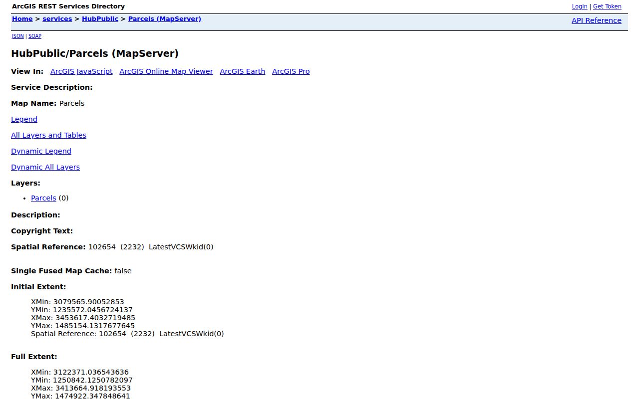
County GIS supplies geometry rather than a household roster. The official parcel service exposes a map layer with a PARCEL field, hyperlink field, object IDs, geometry measures, query tools, and a maximum record count of 2,000. It can return map or data formats, but the REST landing page is technical and does not replace a resident-facing search form. Use an Assessor schedule or parcel number first, then inspect the matching shape.
SpringsView adds a Colorado Springs address or 10-digit parcel search. For a block-level walk, record the service name, layer, query date, scale, adjacent parcel IDs, streets, subdivision, and municipal boundary. Open each adjacent parcel as its own record. A touching polygon does not reveal a person’s name, and map proximity is not identity evidence.
- Confirm the situs and parcel number in the Assessor card.
- Open the county GIS parcel layer or SpringsView and identify the target polygon.
- List adjacent parcel IDs and street edges without assigning a person to them.
- Open each parcel through the official property route if a lawful research question requires it.
The El Paso County parcel map service is the source for the GIS layer used in a street directory workflow.
The SpringsView parcel map adds city address and parcel context for Colorado Springs streets.
El Paso County Permits Fill the Building Gap
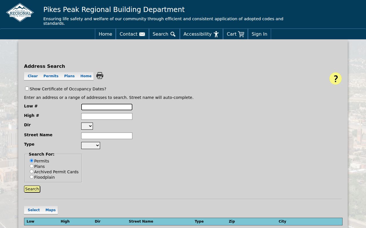
When a street search concerns a structure rather than a person, PPRBD is the relevant address route. Its form uses Low and High number fields, direction, type, a required Street Name autocomplete, and search modes for Permits, Plans, Archived Permit Cards, or Floodplain. A certificate-of-occupancy setting, Open Permits Only, ZIP, city, directions, parcel number, and map links can appear in the result flow. The department serves Colorado Springs, El Paso County, Fountain, Woodland Park, Manitou Springs, Monument, Green Mountain Falls, Palmer Lake, and Calhan.
County Planning’s dashboard covers active and approved applications in unincorporated El Paso County for 2023 through 2026. Colorado Springs’ LDRS and development tracker have different city windows, including records before and after August 8, 2022 in LDRS and applications after January 1, 2024 in the tracker. Older buildings may lack a permit record. A missing row is not proof that no work occurred.
The Pikes Peak Regional Building Department address search supplies the street and number controls used for permit research.
The Colorado Springs Land Development Review System is a separate city route for parcel or tax-schedule records.
For unincorporated addresses, compare the county planning dashboard with the city tools rather than mixing their date windows.
The El Paso County Planning and Development dashboard is the county route for active and approved applications in its stated window.
If a permit, map, or older deed is not exposed online, ask PPRBD or Planning, use the main Clerk and Recorder office for older copies and plats, or file a focused El Paso County CORA request. Historical gaps can move to the PPLD reading room or an archive rather than being filled with a guess.
Follow Deeds Along an El Paso County Street
The Recorder connects a street’s parcel clue to a recorded document trail. Search the person or entity as both grantor and grantee in the real-estate index. Use surname-first formatting, a date range, instrument number, Book, Page, subdivision, lot, block, condominium unit, or legal-land section when available. Document choices such as Warranty Deed, Quit Claim Deed, Deed of Trust, Easement / Right of Way, Plat, Beneficiary Deed, Lien, or Release narrow the question.
Save the instrument number, recording date, party role, document type, legal description, and image status. The Permanent Index coverage line observed during research begins January 1, 1980. The remote image page describes online images from 1996 to present, so an older index line may need main-office copy work. The Recording Department is at 1675 W Garden of the Gods Road, and the office says a requester should supply enough detail for staff to locate a copy.
- Parcel
- The mapped assessment unit tied to a schedule and legal description.
- Situs address
- The physical location assigned to the property card, distinct from a mailing address.
- Plat
- A recorded map that defines lots, blocks, streets, or changes to them.
- Criss-cross directory
- A historical address and name cross-reference used with a publication date.
For a current street directory result, the deed shows the recorded transaction and the Assessor shows the parcel card. Neither alone establishes every person using the address.
Old Colorado City Street Numbers Can Shift
El Paso County address history has a local quirk: Pikes Peak Library District notes that Old Colorado City and Westside street names and numbers changed from the 1870s through 1917, and odd or even numbers sometimes flipped. A historic street directory hit can therefore look wrong while still pointing to the right block. The test is not a modern string match. Compare the old name, cross street, lot or block, plat, Sanborn sheet, and neighboring entries.
PPLD’s house-history guide points to Sanborn maps, with local coverage from about 1883 to 1960 and a large set around 1907, plus plats, GLO records, permits, tapping records, newspapers, and assessor history. A dated map can bridge the gap between a directory’s address and today’s parcel. Record the uncertainty in the note rather than silently rewriting the old form.
County Planning and Colorado Springs mapping tools are useful for the present landscape. They cannot retroactively prove that a historic address meant the same lot. That is why a street directory search needs both a historical source and a current parcel check.
El Paso County Historical Streets Need a Library Check
The Pikes Peak Library District collection lists Colorado Springs directories from 1879 to the present, with gaps. A street-address cross-reference becomes more useful after 1900. Search the alphabetical surname pages and the street or avenue pages in adjacent available years. Rural addresses may need the El Paso County and Teller Rural Directory microfilm, which the Pikes Peak Genealogical Society identifies for 1937-38, 1947, 1949, 1951, 1955, 1962, 1969, and a 1972 book. Telephone books cover most years from 1907 on microfilm.
Historical directories are not a duplicate of the modern property roll. They can show a householder, occupation, spouse, business, lodging house, or community setting at the date of publication. They can miss renters, omit a year, or carry a street form that later changed. When the historical shelf becomes the main task, the El Paso County city directory collection page carries the year runs and reading method.
Check ZIP and Municipality Before Naming a Street
An El Paso County street may sit in Colorado Springs, Fountain, Manitou Springs, one of the smaller incorporated towns, or the unincorporated county. A ZIP can cross that municipal line. The Assessor neighborhood filter is a useful same-name, different-place check, while the voter, permit, court, cemetery, and city-record custodians depend on jurisdiction. Record the city or town shown by the source instead of using the county label for every result.
USPS routing and Census ZCTA geography add another layer. A ZIP code is not a legal city limit, and a ZCTA is a statistical approximation rather than a parcel boundary. If a street search produces a mismatch, keep the original address, then test the parcel number, municipality, ZIP, and map shape separately. A corrected location often explains a blank permit or directory search.
Where an El Paso County Street Directory Stops
A street directory can show a parcel owner, recorded party, project address, voter-product field, or dated household listing. It cannot reveal every occupant, private utility customer, delivery record, or protected address. Assessor owner and mailing fields are not current occupancy proof. Voter records can be confidential. Court, jail, DOC, and registry rows are status-specific and volatile. A historical directory shows what was printed, not an uninterrupted chain of residence.
Use the custodian when a record needs correction, certification, or a lawful access decision. Colorado’s Address Confidentiality Program and El Paso confidential-voter process exist to protect eligible people. A blank result should be preserved as “no result in this portal and query,” never as “no person at this address.”
Lawful personal use. Address research in El Paso County can support house history, family history, neighborhood knowledge, and civic review. Do not use a street trail to stalk, harass, intimidate, or harm anyone.
When the goal shifts from a whole street to one person, use a narrow identity workflow and keep the source relationship attached to the result. When the goal is a historical household, use the library and archive route instead of stretching a current parcel record beyond its purpose.